
History of Pudukkottai District

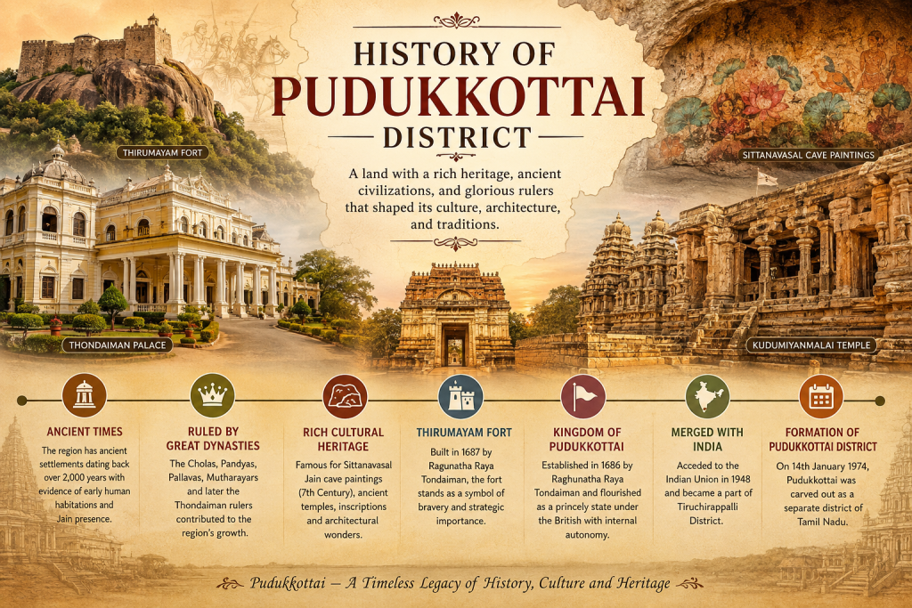
Pudukkottai has a rich and fascinating history that dates back more than 2,000 years, with evidence of ancient human settlements and the presence of Jain communities. Over the centuries, the region was ruled by several great dynasties, including the Cholas, Pandyas, Pallavas, Mutharayars, and later the Thondaiman rulers, who played an important role in shaping its political and cultural development. Pudukkottai is also renowned for its remarkable cultural heritage, including the famous Jain cave paintings at Sittanavasal, ancient temples, inscriptions, and distinctive architectural monuments. Thirumayam Fort, built in 1687 by Raghunatha Raya Tondaiman, stands as an important symbol of the region’s military and strategic heritage. The Kingdom of Pudukkottai was established in 1686 by Raghunatha Raya Tondaiman and later flourished as a princely state under British rule while retaining internal autonomy. In 1948, Pudukkottai acceded to the Indian Union and subsequently became part of Tiruchirappalli District. On 14 January 1974, Pudukkottai was officially formed as a separate district of Tamil Nadu, marking a new chapter in its administrative history. Today, Pudukkottai stands as a timeless legacy of history, culture, architecture, and heritage, preserving the stories and traditions of its glorious past for future generations.
Modern Administration and Geography of Pudukkottai District
Core Geographical Measurements of Pudukkottai District
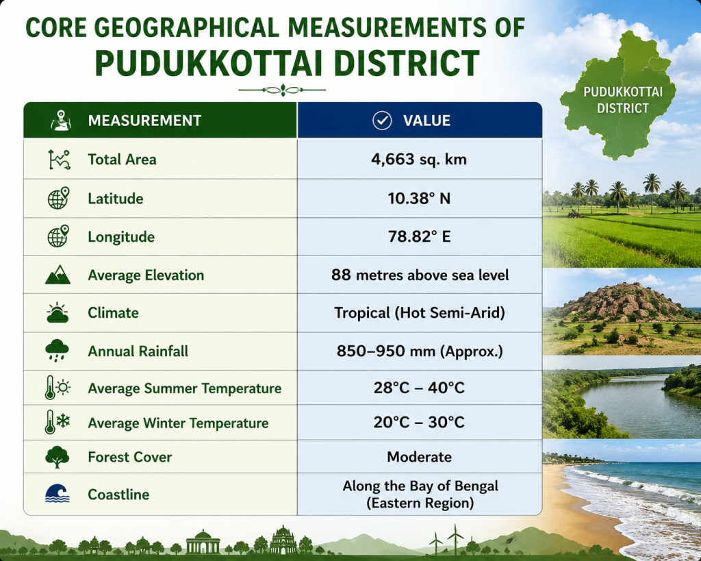
Pudukkottai District covers an area of approximately 4,663 square kilometres and is situated around 10.38° N latitude and 78.82° E longitude. The district has an average elevation of about 88 metres above sea level and experiences a tropical, hot semi-arid climate. Annual rainfall is approximately 850–950 mm, while temperatures generally range from around 28°C to 40°C during summer and 20°C to 30°C during winter. The district features a varied natural landscape consisting of fertile agricultural lands, rocky hills, forests, water bodies, and coastal areas. Its moderate forest cover and natural resources support agriculture, biodiversity, and rural livelihoods, while its eastern coastal region adds to the district’s geographical and ecological
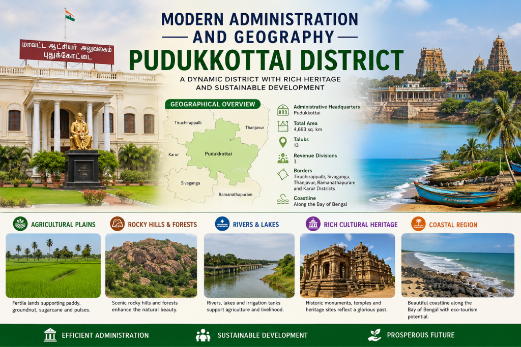
Pudukkottai District is an important administrative region of Tamil Nadu, with Pudukkottai serving as its administrative headquarters. The district covers approximately 4,663 square kilometres and is divided into 13 taluks and 3 revenue divisions for effective administration. It shares its boundaries with Tiruchirappalli, Sivaganga, Thanjavur, Ramanathapuram, and Karur districts. Geographically, Pudukkottai is characterized by fertile agricultural plains, rocky hills, forests, rivers, lakes, irrigation tanks, historic heritage sites, and coastal landscapes. Agriculture plays a major role in the district, with crops such as paddy, groundnut, sugarcane, and pulses cultivated across its fertile lands. Alongside its natural resources, Pudukkottai is renowned for its rich cultural heritage, historic temples, monuments, and archaeological sites. With efficient administration, sustainable development initiatives, improved connectivity, and responsible utilization of its natural and cultural resources, the district continues to work towards a prosperous and sustainable future.
Population & GDP of Pudukkottai District
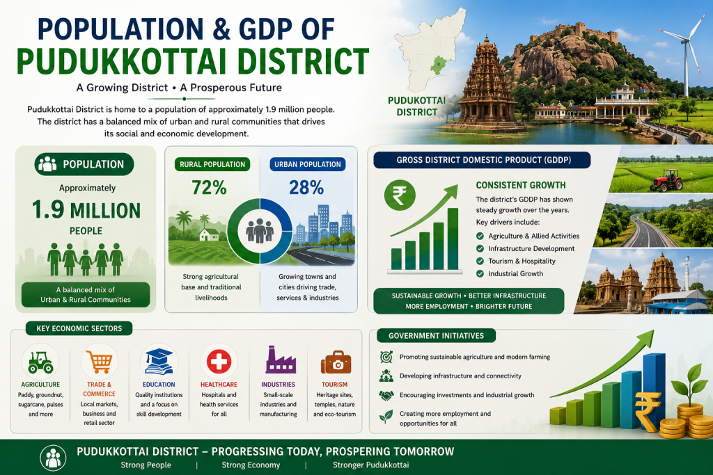
Pudukkottai District is home to a diverse population of approximately 1.9 million people, with a balanced mix of rural and urban communities contributing to its social and economic development. Rural areas form a significant part of the district, supported by agriculture and traditional livelihoods, while growing towns and cities contribute to trade, services, education, and industries. The district’s economy is driven by key sectors such as agriculture, trade and commerce, education, healthcare, small-scale industries, tourism, and allied activities. Its Gross District Domestic Product (GDDP) has shown steady growth, supported by agricultural development, infrastructure improvement, tourism and hospitality, and industrial activities. Government initiatives focusing on sustainable agriculture, better infrastructure and connectivity, investment, industrial growth, and employment opportunities are helping Pudukkottai move towards a stronger and more prosperous future.
Pudukkottai District Statistics
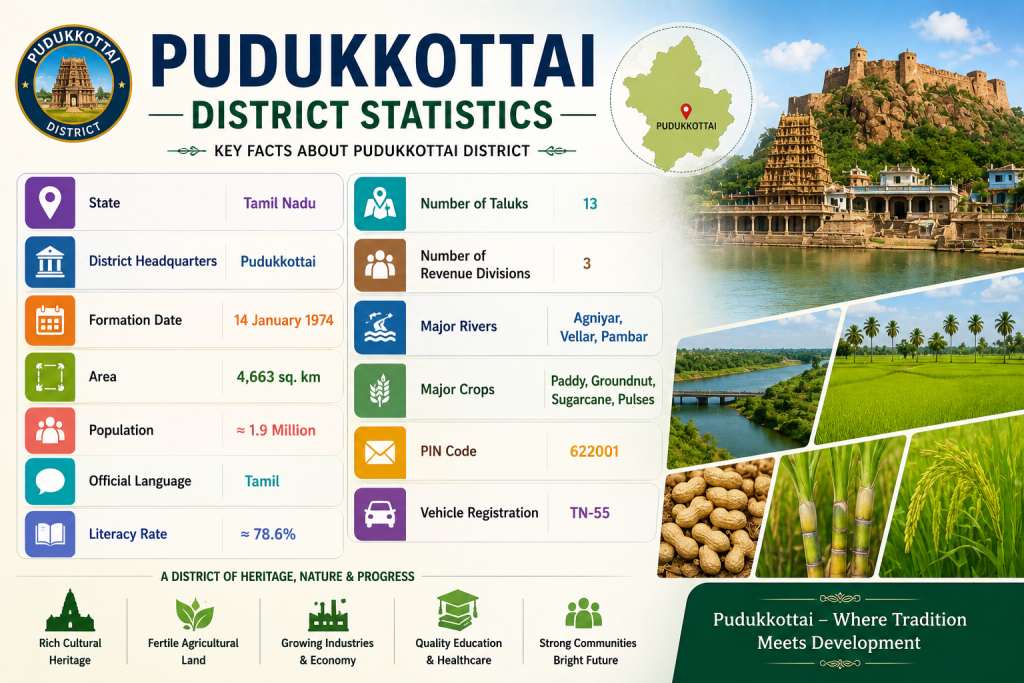
Pudukkottai District, located in Tamil Nadu, is a historically significant and culturally rich district with Pudukkottai as its headquarters. The district was formed on 14 January 1974 and covers an area of approximately 4,663 sq. km. It has a population of around 1.9 million and a literacy rate of approximately 78.6%, with Tamil as the official language. The district is administratively divided into 13 taluks and 3 revenue divisions. Important rivers such as the Agniyar, Vellar, and Pambar support agriculture and local livelihoods. Paddy, groundnut, sugarcane, and pulses are among the major crops cultivated in the region. Pudukkottai also has a strong cultural heritage, fertile agricultural lands, growing industries, educational and healthcare facilities, and close-knit communities. With its rich traditions, natural resources, agricultural strength, and expanding economic opportunities, Pudukkottai represents a district where heritage, nature, and development come together to create a promising future.
Why Visit Pudukkottai District
Pudukkottai District
Exploring 12 revenue taluks, heritage landmarks, coastal landscapes, and local economic life